 Filter: Categories of Wisconsin Historical Images
Filter: FORMAT_DIMENSIONS of 59 x 45 cm.
Filter: Categories of Wisconsin Historical Images
Filter: FORMAT_DIMENSIONS of 59 x 45 cm.
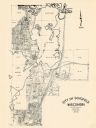
| Date: | 1965 |
|---|---|
| Description: | This map shows lot and block numbers and dimensions, additions, streets, and railroads. |

| Date: | 1900 |
|---|---|
| Description: | This photostat map was probably originally created in 1835 and shows in addition to private claims, mills, roads, and trails. Green Bay and the Fox River a... |
| Date: | 1900 |
|---|---|
| Description: | This map shows distances along the road, rivers, Indian trails between a shantytown south of Navarino (Green Bay)and Fort Howard. It also shows Lake Winneb... |
If you didn't find the material you searched for, our Library Reference Staff can help.
Call our reference desk at 608-264-6535 or email us at: